01
Teleport
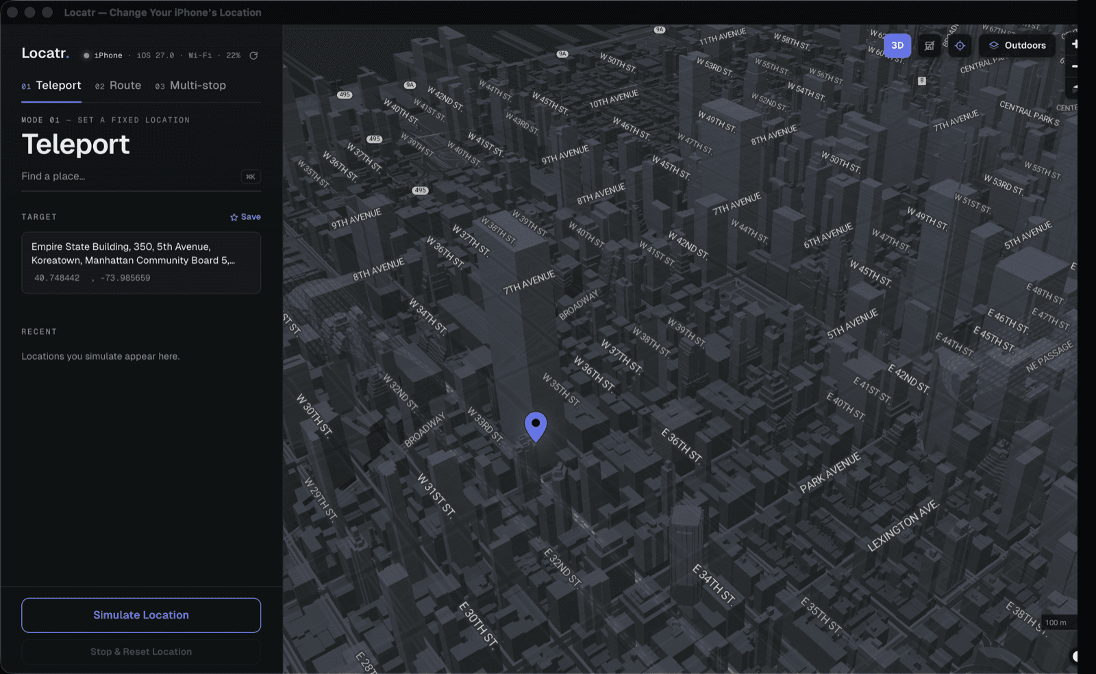
Jump straight to a coordinate. Search for a place or paste a lat/lon, and the device reports itself there — no movement, no interpolation.
Typical use
Region gating, localised content, distance checks
Locatr is a Mac app that puts your iPhone anywhere in the world. Teleport to a coordinate, drive a route, or run a multi-stop trip — with snap-to-road accuracy, a 3D map, and GPX in and out.
Email and password. Nothing else required.
Most location bugs are really movement bugs. Locatr separates the two so you can reproduce either one deliberately.
Jump straight to a coordinate. Search for a place or paste a lat/lon, and the device reports itself there — no movement, no interpolation.
Typical use
Region gating, localised content, distance checks
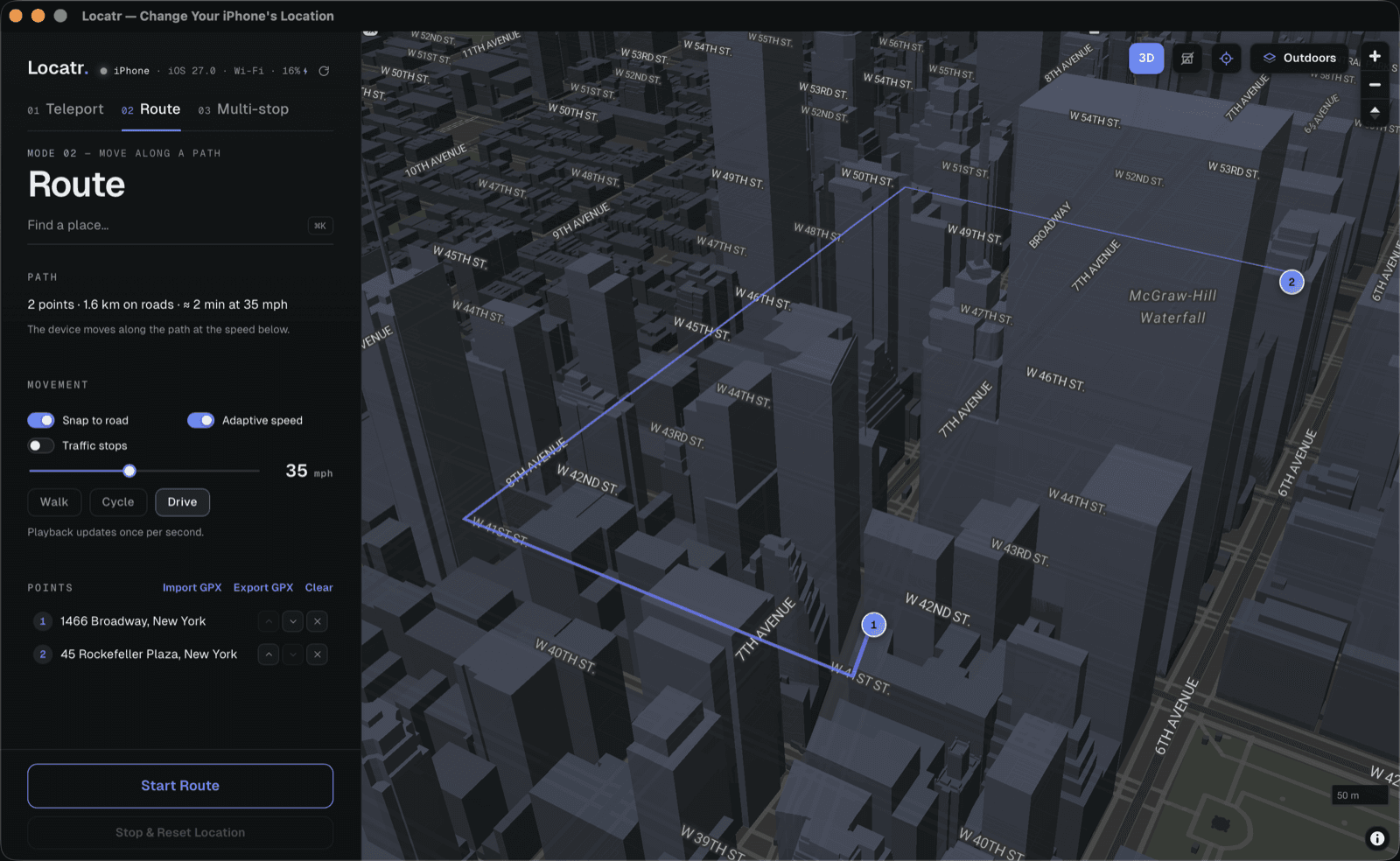
Follow a continuous path from start to finish, so movement-dependent logic runs the way it would on a real trip.
Typical use
Geofence entry and exit, live tracking
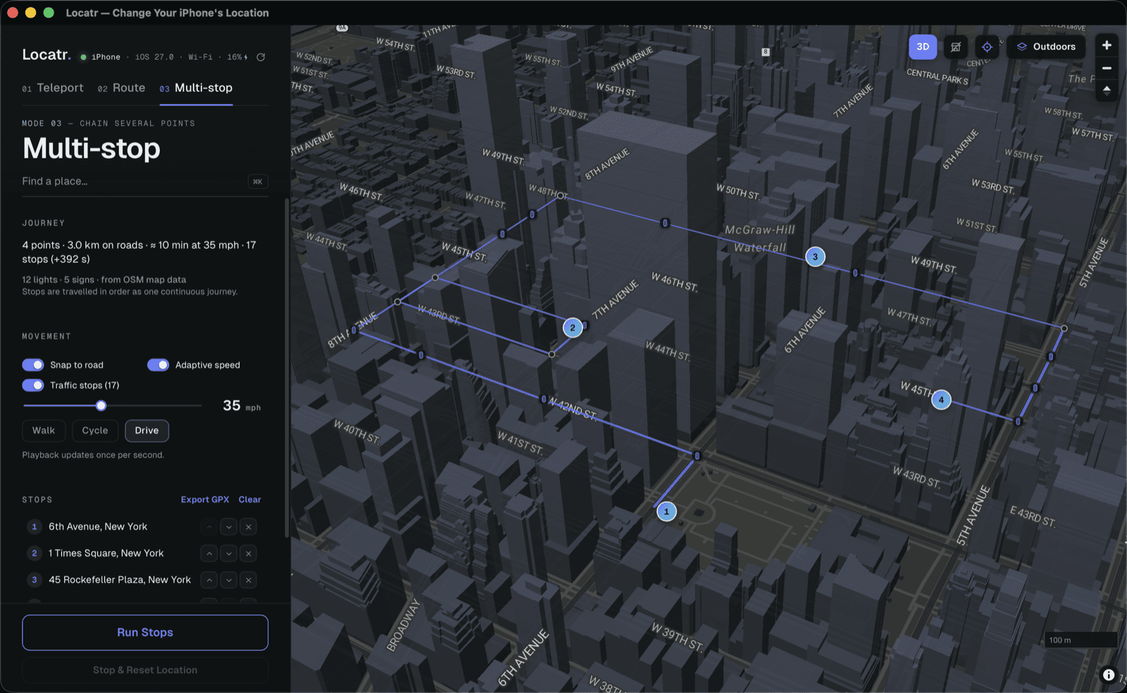
Chain several waypoints into a single trip and run the whole sequence end to end, in order, without babysitting each leg.
Typical use
Delivery flows, itineraries, multi-leg journeys
Waypoints pull onto the road network, so a simulated drive follows streets instead of cutting a straight line through buildings. The path your app receives is the path a real trip would take.
Tilt and orbit the map to check a route against the street layout before you run it.
Bring in a track you already have — a real recording or something from another tool — and replay it.
Save a route as GPX to reuse later, share with a teammate, or keep next to your test cases.
Search for an address or drop a point on the map. Locatr resolves it to a coordinate you can see and copy.
Teleport for a single fix. Route or multi-stop when the movement between points is the thing you need to test.
Watch the simulated position advance on the map, and export the run as GPX when you want to keep it.
What it does, what it doesn’t, and what you’re responsible for.
It changes what location your iPhone reports, from your Mac. Connect the device over USB or Wi-Fi, pick a point on the map, and the phone reports that position system-wide — so anything that depends on where you are (geofencing, regional content, delivery flows, ride-share logic, weather) behaves as though you were there. Under the hood it drives Apple’s own developer location-simulation service: the same mechanism Xcode’s “Simulate Location” uses.
Real devices. Locatr detects connected iPhones over both USB and Wi-Fi and shows each one’s name, iOS version and connection type — a cabled device can be switched to Wi-Fi with one toggle. The phone needs three one-time steps first: unlock it, tap Trust This Computer, and turn on Developer Mode under Settings → Privacy & Security (iOS 16 and later; the phone reboots once when you enable it).
It makes no persistent changes. The simulated position exists only inside the device’s developer service — it never touches your real GPS hardware, your saved data, or iOS itself, and there’s no jailbreak involved. It ends the moment you hit Stop & Reset, reboot the phone, or disconnect, and the device goes straight back to reporting its real location.
macOS only. Locatr is a Mac app that drives a connected iPhone — you need both. There’s no Windows or Linux build, and no iPhone-only version: the simulation has to be driven from a computer the device trusts.
7 days, free. A card is required to start it — that’s how the subscription is set up — but you aren’t charged anything until the trial ends, and the checkout page shows $0.00 due today. After that it’s $9.99 a month or $59.99 a year.
Yes, from the billing portal linked in your dashboard — no email, no support ticket. Cancelling doesn’t cut you off on the spot: Pro access continues to the end of the period you’ve already paid for, then the account reverts to free.
Worth an honest answer. The mechanism itself is Apple’s own — the developer location-simulation service, the same one Xcode exposes. Locatr isn’t a jailbreak, an exploit, or a patch to iOS. But it’s a Mac app distributed directly rather than through the Mac App Store, so it hasn’t been through Apple’s review, and nothing here is endorsed by or affiliated with Apple.
In practice Apple usually isn’t the constraint — the terms of whatever app you point this at are. Many services treat a falsified location as a violation of their own rules, and some actively try to detect it. That part is between you and them, and it’s worth reading before you rely on it.
It’s built for testing apps on devices you own or are explicitly authorised to test — the case Apple’s simulation service exists to serve. Using it to misrepresent your location to third-party services, against their terms, is not what it’s for.
How you use Locatr is your responsibility, not ours.
Create an account to get started. It takes an email address and a password.